Nepal And China Remeasuring Mount Everest Height !
For many years, it has been a question of general knowledge that 'What is the height of Mount Everest the highest mountain on Earth?' The answer to this question has been given for 8848 meters, but now you will have to take the updated books of General Knowledge so that you can answer this question correctly.
Yes, both countries have almost completed the process of re-measuring the height of Everest or Sagarmatha on the border of Nepal and China. A new figure may be revealed soon.
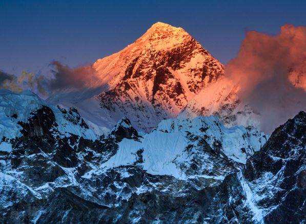
The second highest mountain peak in Everest PoK, situated in the middle of the Himalayan mountain range, is about two and a quarter to two hundred meters high. The peak was named after the British geographer Sir George Everest, who was Surveyor General in India in the mid-19th century.
After this, the height was fixed after measuring again in the middle of this 20th century. However, why it is being measured again and it is interesting to know about the history and methods of measuring the height of Everest.
First of all, it is necessary to know what has been the controversy over the height of Everest. In 1856, the Great Trigonometric Survey (GTS) Survey of India, determined 8840 meters high. After this, in 1955, the Indian survey determined the height 8848 meters, which China confirmed in 1975. But with the help of GPS and radar technology in 1999, the US survey claimed that the actual height is 8850 meters.
After this, China again measured it in 2005 and claimed that the height was 8844.43. After all these claims, the height of Everest became disputed. According to experts, despite the permanent rock summit, there is a difference in the thickness of Everest every year. Nepal and China together are measuring again the height of Everest due to all these reasons. But is this the only reason?
The GTS is a story of recognition of the height of Everest in the 19th century. It is said that at that time the height was measured at 29000 feet, which meant 8839 meters. But at that time it was thought about this figure that people would not believe such an exit figure, so it was an exercise to fix it 29002 feet i.e. 8840 meters by adding two feet more according to it. However, no strong evidence is given behind this belief.
Since 1956, the height of Everest has been officially considered to be 8848 meters, which was decided by the Survey of India. There has been talking of a change in the height of Everest due to the movements within the Earth-like Nepal earthquake in 2015. On the other hand, it has also been a fact that the height of Everest also depends on which country was measuring.
The second debate about the height of Everest is also how far should it be measured? That is, to the highest rock point or to the highest ice point? Nepal and China agreed that Nepal's height up to the ice point was 8848 meters in 2010 after agreeing on this matter and China's claim of 8844.43 meters is right for the height up to the rock point.
After this, when the current President of China, Xi Jinping visited Nepal in 2019, the two countries agreed to release a shared analysis after measuring the height of Everest again. But the matter does not end here.
Yes, these are all technical things, which are kept in front of the world. An important and inside thing is that all the valid surveys conducted earlier were all done through Indian, American or European surveyors. Since Everest is located on the border of Nepal and China, now both countries want to give official figures to the world according to their own.
READ HERE MORE : Know About Aditya Thackrey AKA "Baby Penguin"
The Nepal team completed the Everest survey last year, while China completed the survey in May this year amid the havoc of the coronavirus. According to a detailed report of the Nepali Times, Nepal has taken the base of the sea level from the Bay of Bengal while China has taken the Yellow Sea from the Yellow Sea.
It has also been saying that Nepal's data is ready and it is waiting for the final calculation from China. Secondly, due to the epidemic, the date of the official announcement has been extended somewhat.

I am a Website Developer. And Write Articles on health, general, SEO, gaming, real estate, movies, songs and other reviews. and i also work on SEO search engine optomization.