07-Apr-2023
All you need to know about NASA-ISRO SAR Satellite
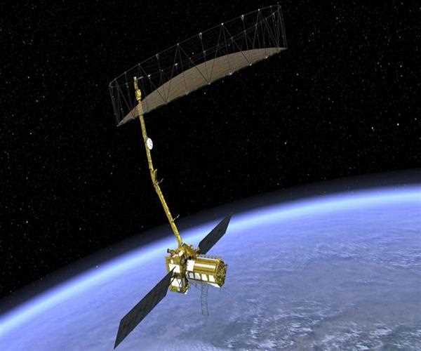
The NASA-ISRO SAR Satellite, also known as NISAR, is a joint mission between the National Aeronautics and Space Administration (NASA) and the Indian Space Research Organization (ISRO). The satellite is designed to provide high-resolution, three-dimensional images of the Earth's surface using a state-of-the-art radar system.
The NISAR mission was first announced in 2014, and it is scheduled to launch in 2023. The satellite will be placed in a polar orbit, allowing it to image the entire globe in approximately 12 days. It will use a dual-frequency Synthetic Aperture Radar system (SAR), which will operate at L-band (24 cm wavelength) and S-band (12 cm wavelength) frequencies.
One of the key features of the NISAR mission is its ability to provide high-resolution, three-dimensional images of the Earth's surface. The SAR system works by transmitting radar signals towards the Earth's surface and then measuring the signals that are reflected back. By analyzing these signals, the satellite can create detailed images of the Earth's topography, as well as detect changes in the Earth's surface over time.
The NISAR mission will have a number of applications in fields such as environmental monitoring, disaster management, and agriculture. For example, the satellite will be able to monitor changes in the Earth's surface, such as the melting of glaciers and the movement of tectonic plates. It will also be able to detect changes in vegetation cover, which can provide valuable information for farmers and other stakeholders.
In addition to its scientific applications, the NISAR mission is also significant because of its collaborative nature. The joint mission between NASA and ISRO represents a significant step forward in international cooperation in space exploration. It is also an example of how collaboration between different countries can lead to the development of new technologies and the advancement of scientific knowledge.
Overall, the NASA-ISRO SAR Satellite is an exciting mission that has the potential to provide new insights into the Earth's surface and the changes that are taking place on our planet. The satellite's high-resolution imaging capabilities, coupled with its collaborative nature, make it a significant milestone in the field of space exploration. It will be interesting to see what new discoveries and insights emerge from the data collected by the NISAR mission, and how these discoveries will shape our understanding of the Earth and its environment.

SEO and Content Writer
I am Drishan vig. I used to write blogs, articles, and stories in a way that entices the audience. I assure you that consistency, style, and tone must be met while writing the content. Working with the clients like bfc, varthana, ITC hotels, indusind, mumpa, mollydolly etc. has made me realized that writing content is not enough but doing seo is the first thing for it.
Join Our Newsletter
Subscribe to our newsletter to receive emails about new views posts, releases and updates.
Copyright 2010 - 2026 MindStick Software Pvt. Ltd. All Rights Reserved Privacy Policy | Terms & Conditions | Cookie Policy